Kayak Party!

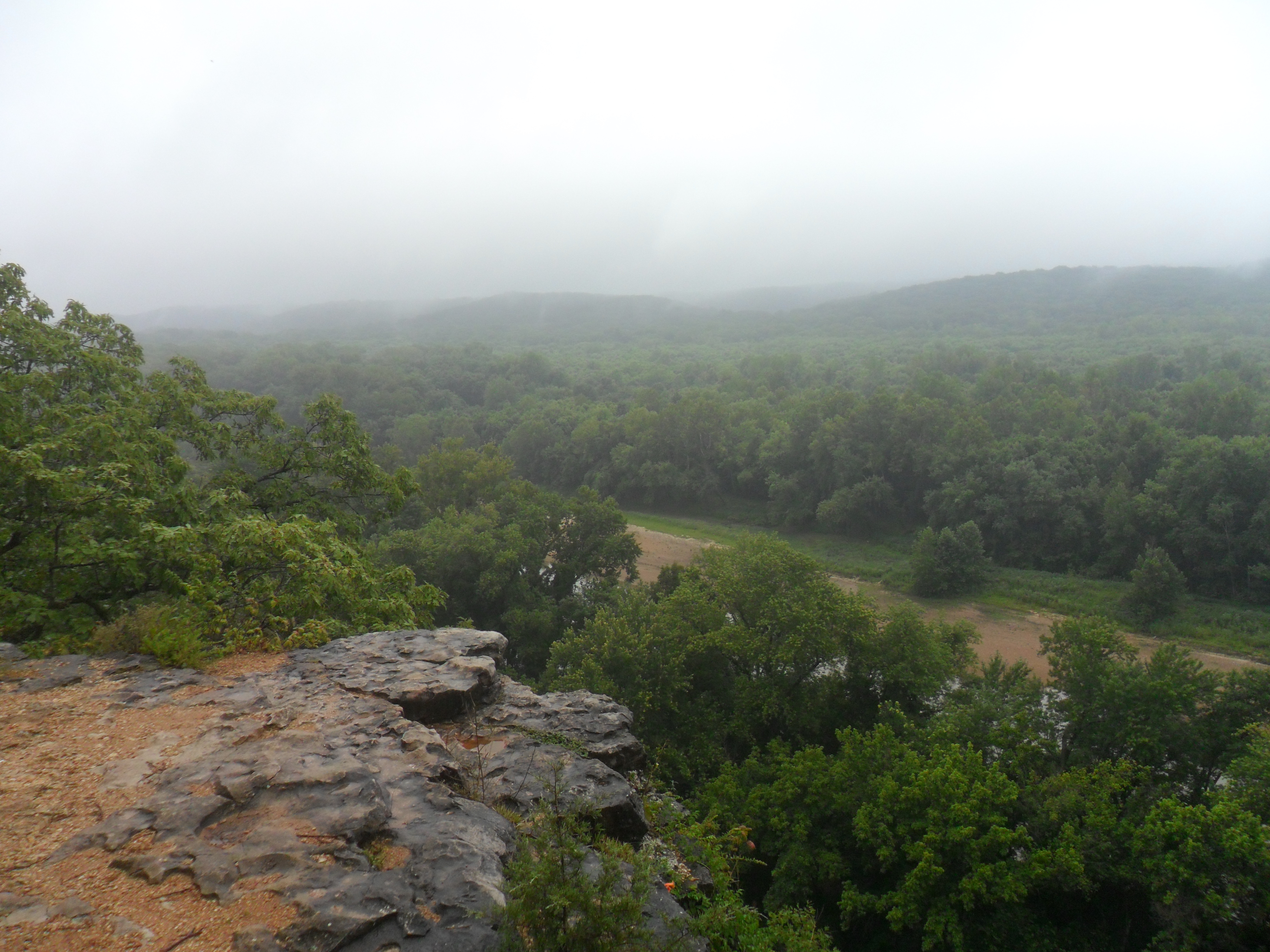
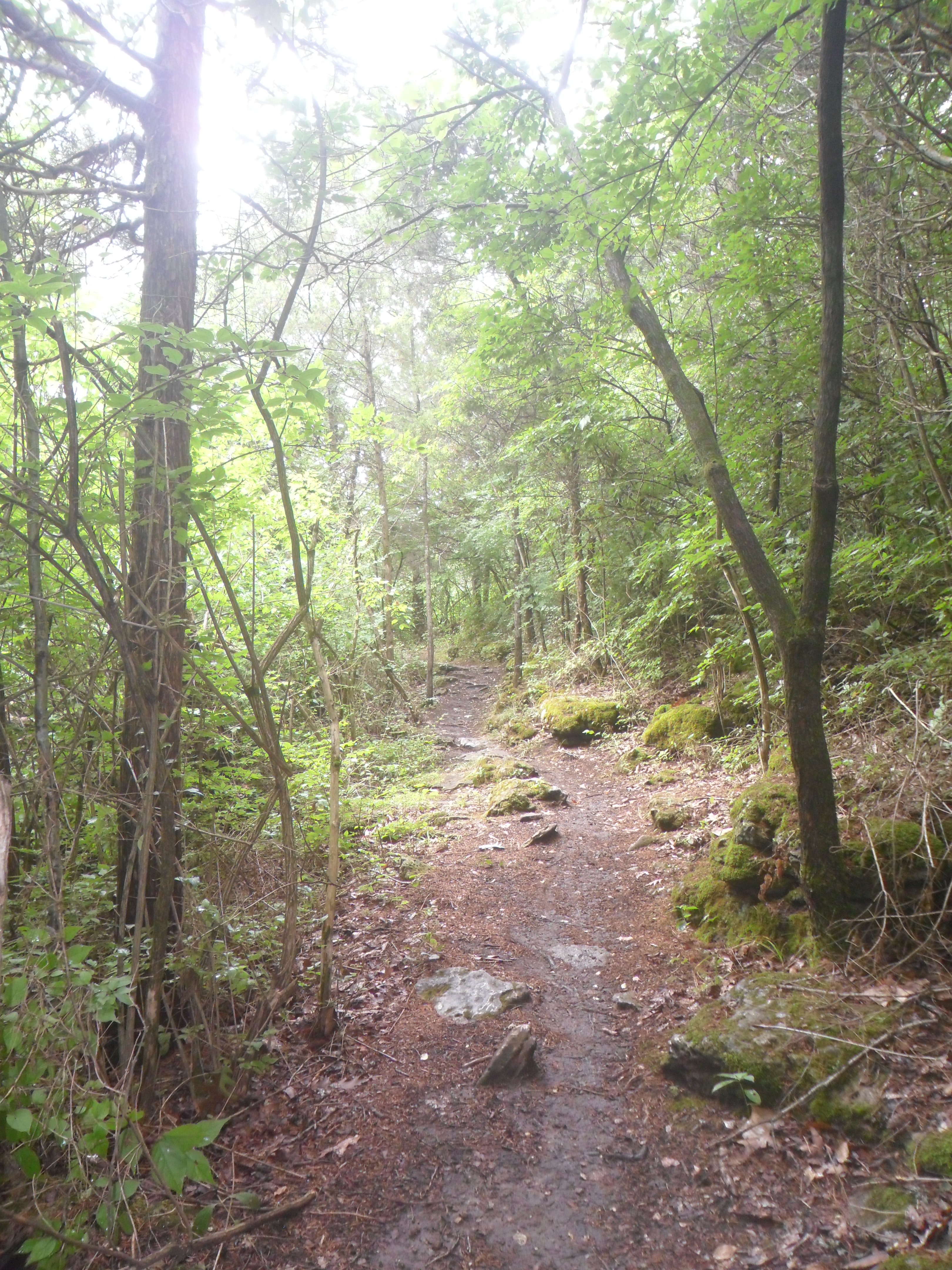
Last summer I went on my first river trip with the boyfriend and some friends. We decided to go to the Current River for a two day trip, 22 miles with camping on the river overnight. The boyfriend owns a couple of kayaks and we thought it would be fun and cheap to take them out to the river with us. The problem is, we didn’t really have a vehicle to transport them in that also had room for three people. So, tragically, I asked to borrow my dad’s old roof racks from the 70s (he used to do some white water kayaking in a kayak that he made himself–people are just not that hardcore anymore). Obviously, we see where this is heading. The roof racks seemed to fit my car perfectly. I drove my car around for two days with them on it without any issues.

These issues, however, surfaced with the weight of two kayaks on them. I remember telling the guys over and over again, “Are they firmly on there? Check the racks, are they still tight enough? Check the kayaks again!” I was paranoid from the beginning, for good reason. The kayaks seemed rock solid. The racks seemed immobile. We left the boyfriend’s place (across the Mississippi from me, by the way) to park the car at my house for the night before leaving for a very early morning the next day. About 10 miles from the Mississippi, I decided to look up at the kayaks from behind the wheel for the billionth time and thought, “They’ve definitely moved back–OH *EXPLETIVE*!!!! (you can insert whatever word you want there, they all work).” The boyfriend firmly told me  to “CALM DOWN. Pull over. It’s going to be okay.”

That’s how I left my boyfriend sitting on the median of a busy highway with two kayaks at 11 o’clock at night.

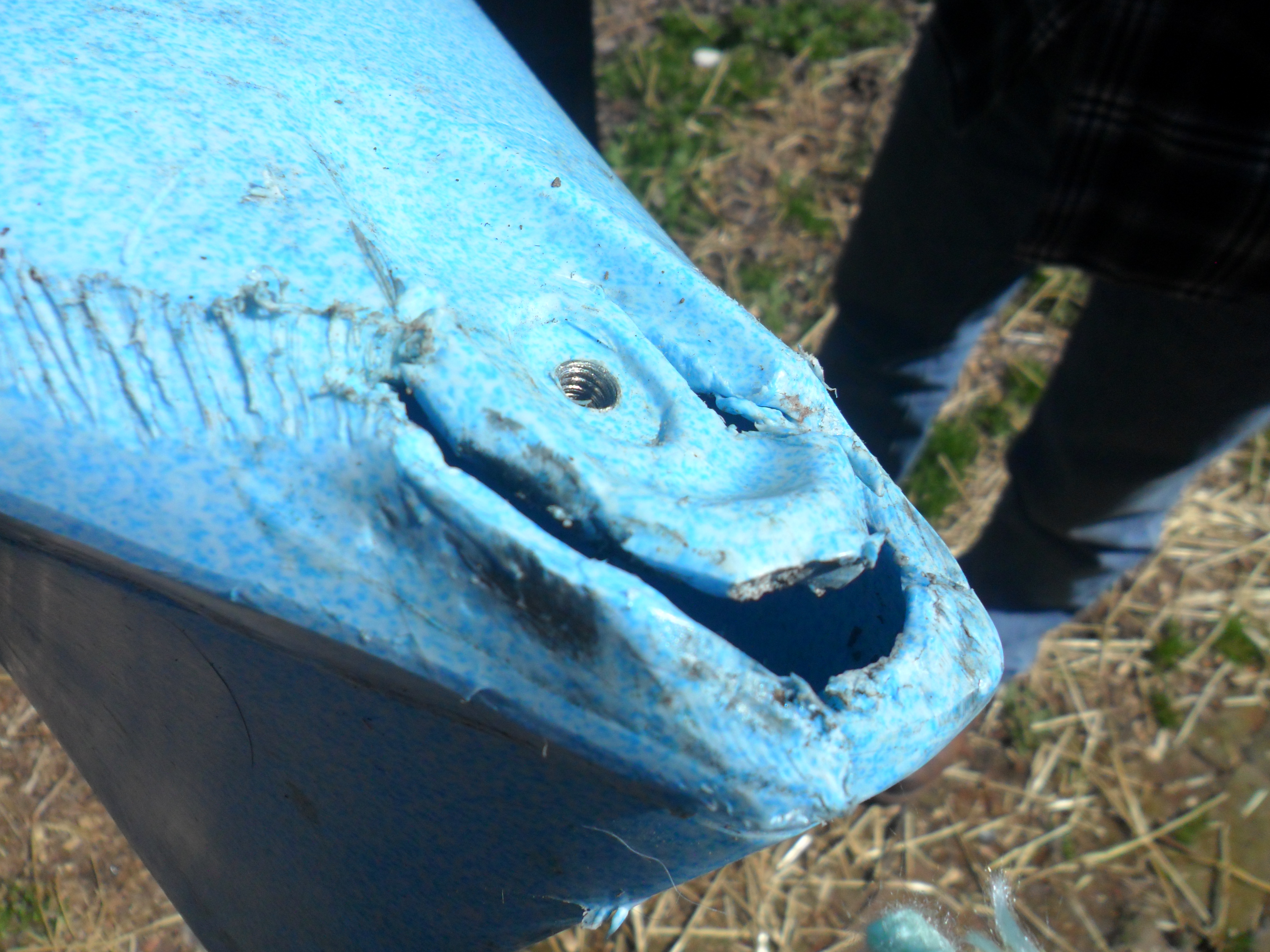
There wasn’t much else we could do. He and the friend that was with us darted around the highway, grabbing the kayaks and the back rack that had slid off of my car. We had to leave the boyfriend on the highway while he waited for his brother to pick him up in his truck so that we could get to my house and finish getting everything ready for the weekend. The green kayak, playfully named Wobbles due to its inability to go straight, was hit by several cars and was perfectly fine (go figure, the cheap boat survives the Kayak Apocalypse). The blue Perception, however, wasn’t so lucky.

We still went on our trip and had a great time and some other adventurous/traumatic events occurred. But I’m not here to talk about those times right now, maybe I will on another occasion. Instead, I’d like to share a rough outline of the Perception’s rebirth along with our first kayak outing of the season.

Kayaks don't really work so well on highways, friends.

Kayaks don’t really work so well on highways, friends.

As you can see, the kayak took some damage. It wasn’t anything that totally retired it, but it was put out of commission until April of this year. I gave it a name, the Road Warrior, in the hopes that the event would give it a little mystery when we cross paths with other people. I mean, it fits, right? And would you not be curious if you met someone on the river who claimed their kayak was named the Road Warrior?

The Road Warrior

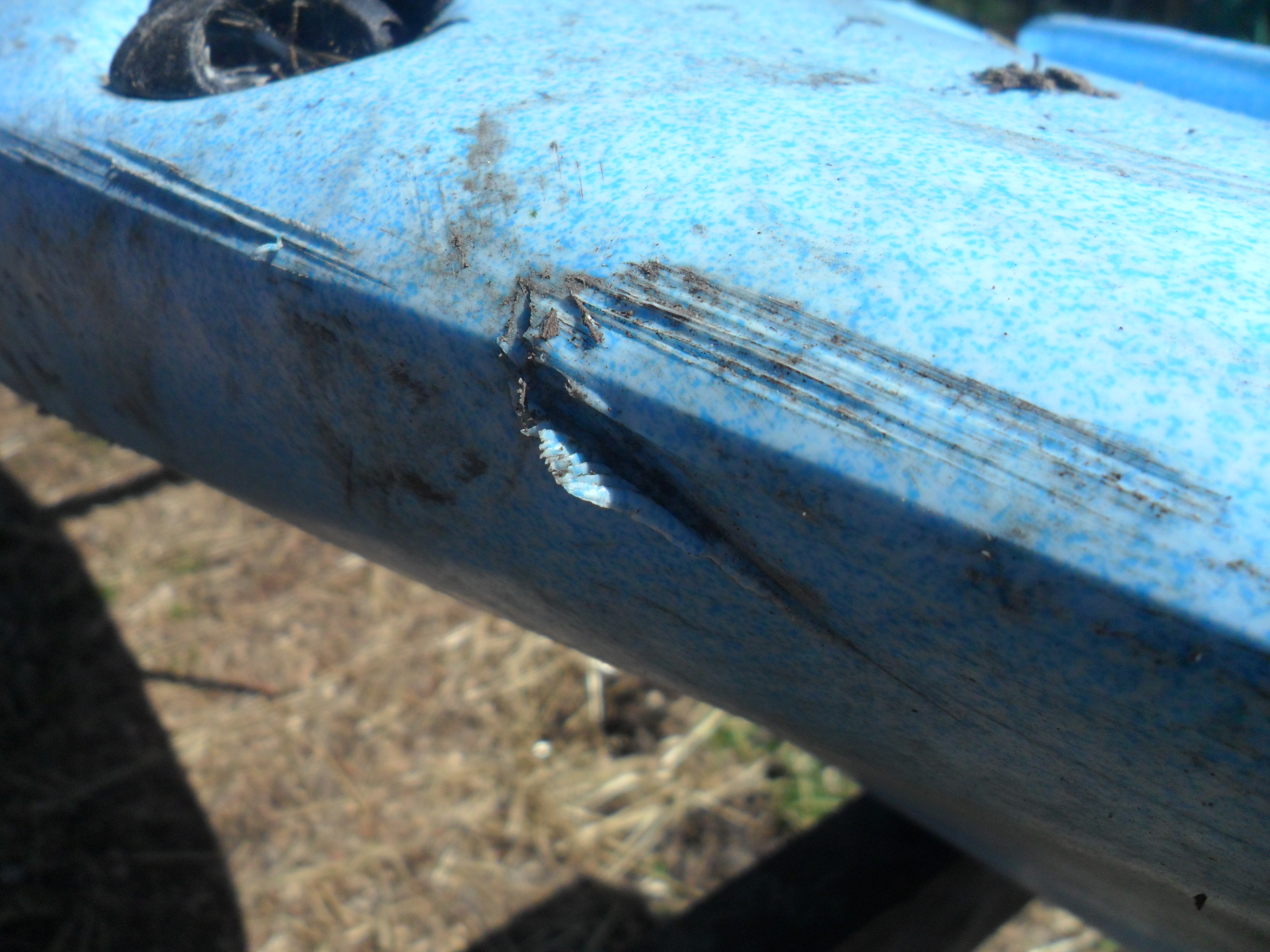
It got busted up real good.

So the boyfriend was determined to fix the Road Warrior before this summer, which was great news for me. No one really fits in the Road Warrior beside me–so hey, I get to bum a kayak all the time. I helped him find a kayak repair kit that looked promising, and luckily, it worked wonders. The kit that was used was sold by the Urethane Supply Company, and can be found here.

I won’t get too thorough with the details of repairing it, since I only observed and got in everyone’s way so I could take pictures. But these pictures and captions give a rough outline of it. They used a heat gun along with the welder that came with the kit, and I highly recommend that anyone who uses this type of repair kit do the same.

The Road Warrior

The plastic that was a lost cause was cut away, making a clean space for mending.

The Road Warrior

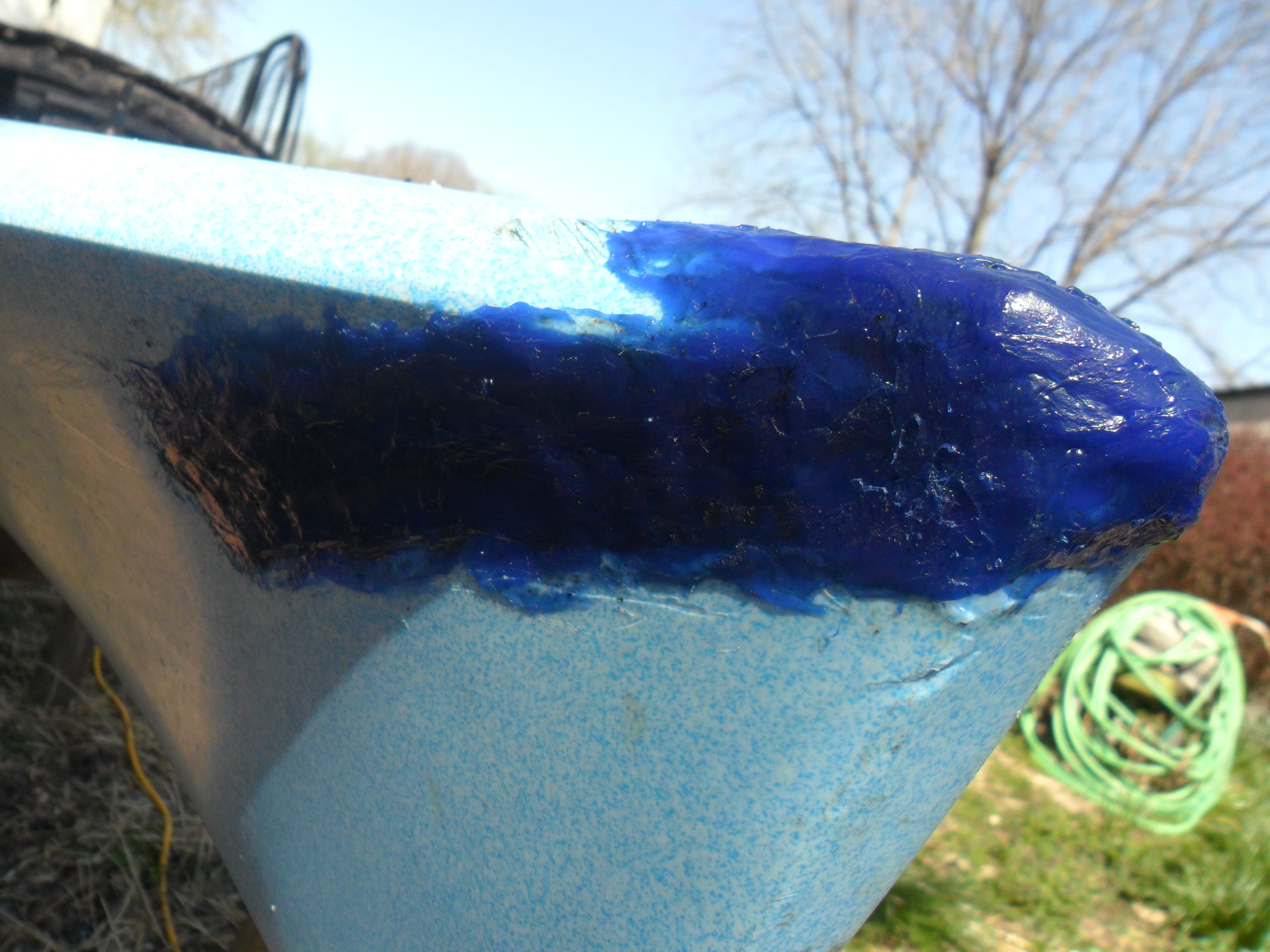
A metal screening was placed over the cracks to provide scaffolding using a small welder from the kayak repair kit.

The Road Warrior

The task of melding the plastic to the kayak begins!

The Road Warrior

The patch, before sanding and smoothing!
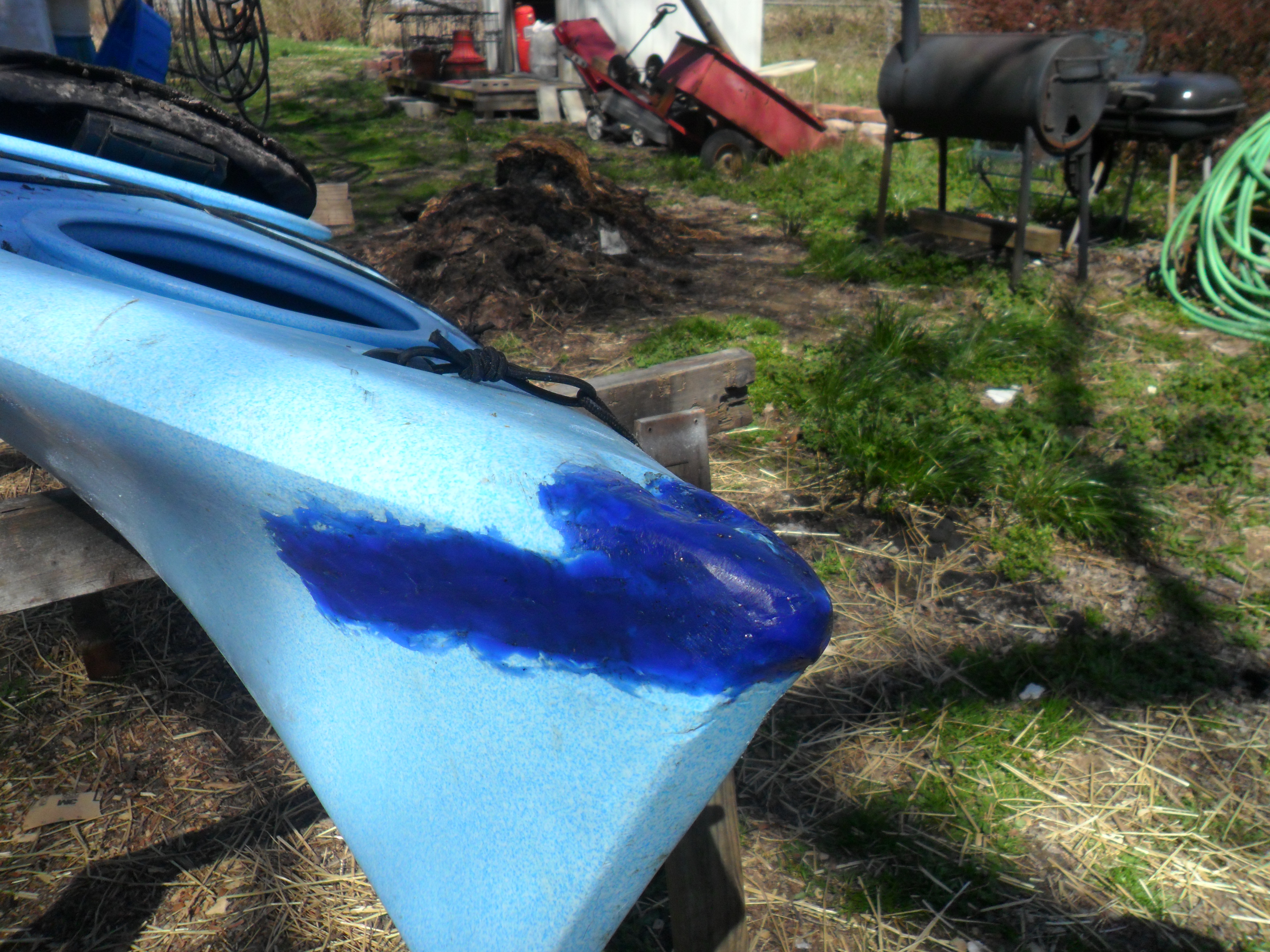
The Road Warrior

Ain’t he a beaut?

The Road Warrior turned out pretty fabulous! I’ve been out on him (that’s right him) three times since the repair, and it’s a solid patch.

The Road Warrior

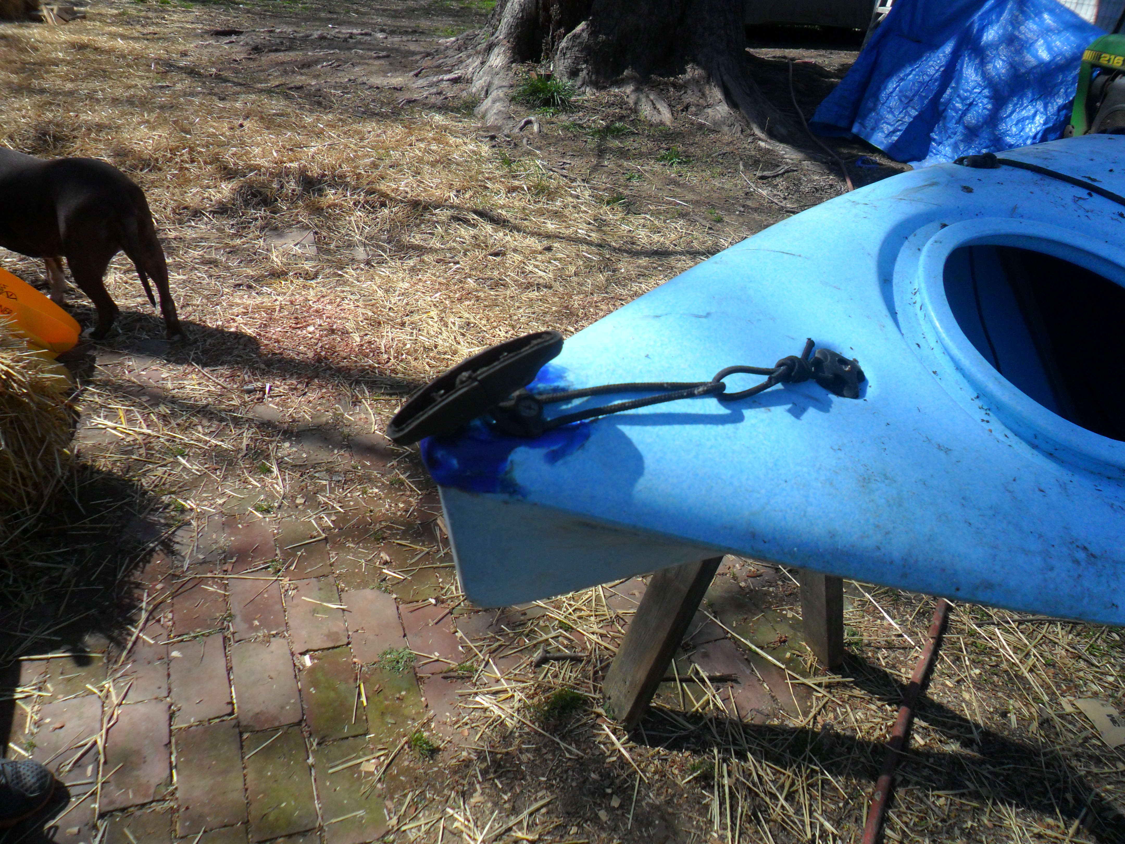
Better than new! I hope people see this beautiful repair and think that I was up to some gnarly kayaking.

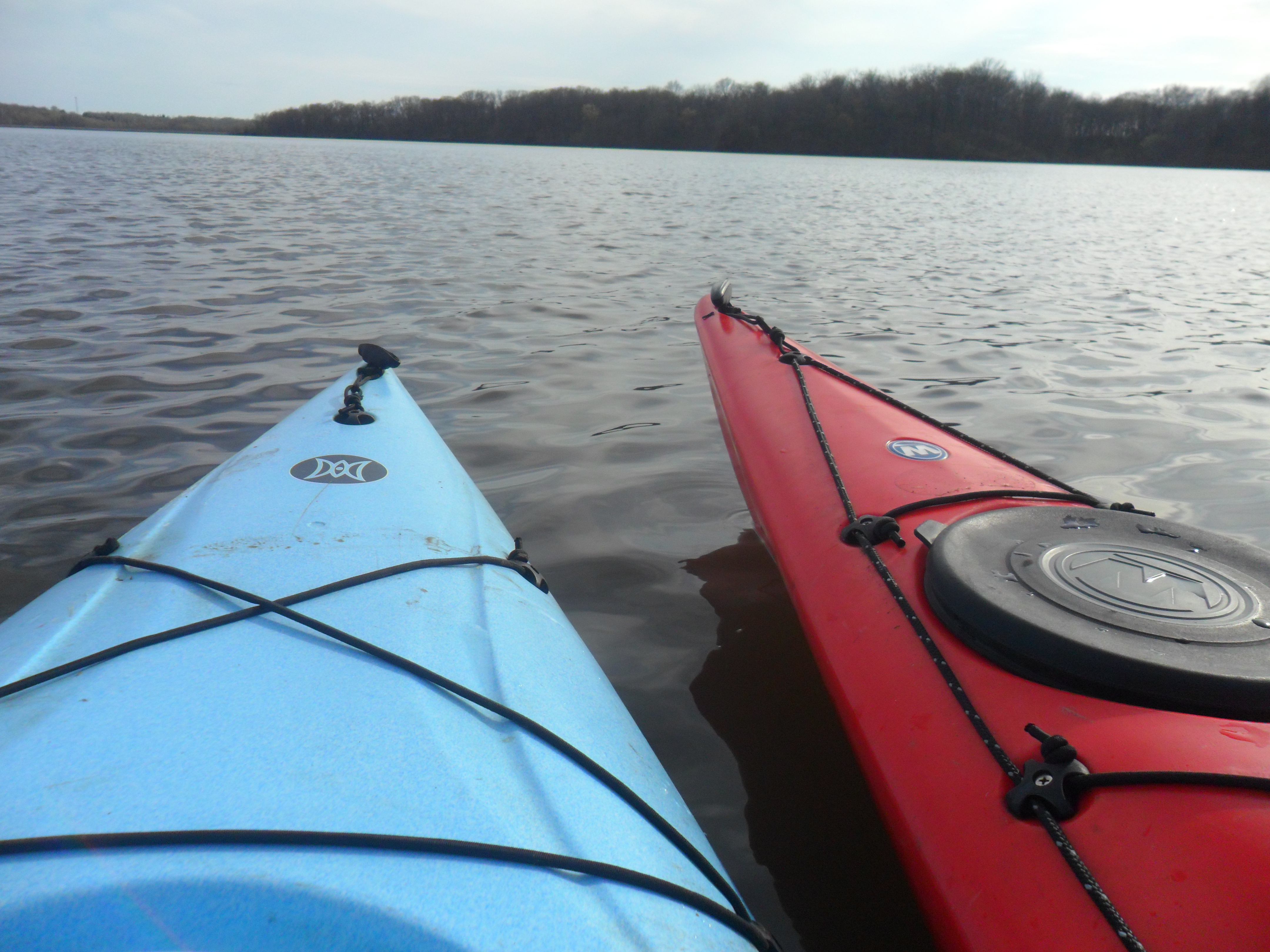
We took Wobbles and the Road Warrior out to Silver Lake in Highland, IL, not too long after this repair. A new kayak, one that is much fancier than the others, made this trip as well. The boyfriend bought a 13’6″ Wilderness Tsunami Kayak during the Alpine Shop’s big kayak/canoe sale in the Spring. For half price! A little wear from trial runs is no big deal for that steal. It’s a real nice kayak that I really dislike using because of its size. I’m told that the rudder on it is great, though.

He named it, even though I said it had to earn a name. Big Red. I guess it’s fitting.

Seriously, this thing is too big for me to get in in one shot from the dock.

Seriously, this thing is too big for me to get it in one shot from the dock.

We took our friend out with us, which was his first time on a kayak. He unfortunately has only experienced Wobbles, because, well, Big Red is boyfriend-sized and Road Warrior is me-sized. He has learned to tame the Wobbles quite well, however.

Why does one person need three kayaks? No arguments here, though...

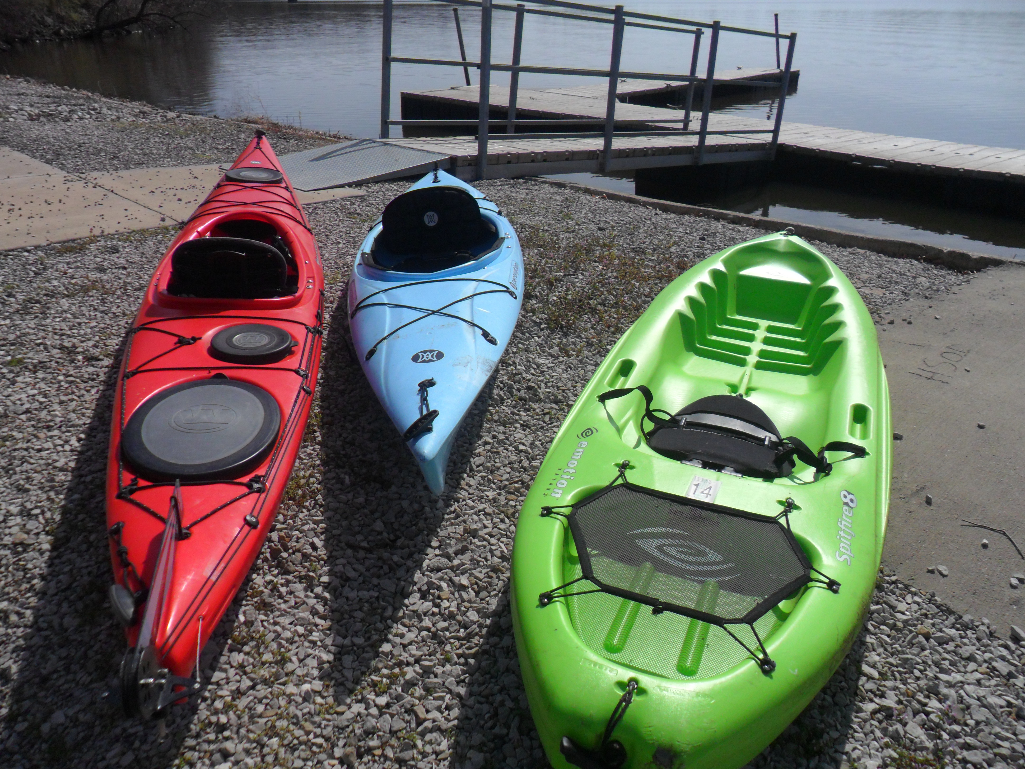
Why does one person need three kayaks? No arguments here, though…

It was a fine day for kayaking, and got me back into the water after the yet unexplained events of last summer.

Road Warrior and Big Red

Big Red

Get out and kayak, folks. I mean it.

Castlewood State Park: River Scene Trail, Stinging Nettle Loop, and Cedar Bluff Loop

I decided to begin this project with a park that is well known and loved by many people in the St. Louis Metro Area: Castlewood.  Located in the suburbs, Castlewood is a popular place for trail runners, mountain bikers, and family outings.  But many people don’t realize the massive amount of hiking that we have access to from this park.  In the main park alone, there is 11 miles worth of trails, but another 10 miles are available just a short, slightly illegal, walk away.

If you’ve ever been to Castlewood, you’ve heard the historic spiel about the park already.  You know that between WWI and WWII, Castlewood was a party destination.  People would come by the thousands during the summer via car, train, and boat, in order to swim, canoe, dance, drink (illegally, those fiends!), and just have a swell time.  It’s hard to see it now, but this place was a hotbed of activity.  If you keep an eye out during your hikes, you’ll see the remains of a grand stairway and old houses.

But that’s not why people come here these days.  People come for the view.

Every time I bring someone to Castlewood for their first time, I take them up what must be my least favorite hill in the County (at least, so far).  It’s technically the beginning of the Lone Wolf Trail, but its proximity to a parking lot makes it the start of the River Scene Trail for most people.  It’s long, it’s steep, and it’s covered in loose rocks.  I huff and I puff with whoever I hike with, assuring them the whole way up that the view will be worth it and that it’s best to just keep going.  You don’t really want to lose your momentum, do you?

Eventually the hill is over, and you’re greeted with the edge of the bluff.  There are better look out points than what’s at the immediate end of the hill–but after all that work, you don’t want to wait.  Catch your breath and look out.  I won’t say that the Meramec is the most beautiful river in Missouri–it’s not even close–but it’s home.  From the top of the River Scene Trail, you can see the Meramec winding its way through the land.  On the other side of the River is more park land, so you can see trees, and more trees, and more trees, and it’s wonderful.  Sure, you can still see buildings in the distance.  But what do you want?  We’re still in St. Louis County, afterall.

The view from the bluffs of the River Scene Trail at Castlewood State Park.

The view from the bluffs of the River Scene Trail at Castlewood State Park.

As you continue along the trail atop the bluffs, you’ll go through trees and minor inclines and declines.  Now and then the trees will clear out and you’ll have a new, wonderful view of the River below and sometimes see and hear a train speeding by along the tracks below.  My favorite overlooks are the ones that aren’t railed in.

Appreciate the rocks!  Stand on them and feel like you're king of the world!

Appreciate the rocks! Stand on them and feel like you’re king of the world!

Eventually, you’ll reach a set of wooden stairs.  Get used to these stairs–in fact, become best friends with these stairs, because you’ll be on them for a while.  Personally, I always start on the giant, rocky hill, just so I can go down these steps instead of up.  You won’t see over the bluffs once you’re on these stairs, but you’ll get to spend some time in the woods.  As you near the end of the steps, you’ll see another set of stairs–the grand stairs of yesteryear!  They don’t look like much anymore, but it always gets the wheels turning in my head and I wonder what this place was like when it was bumpin’.  At the bottom of the stairs, you’ll pass under the train tracks.

Cut under the train tracks via this (apparently) really old tunnel and get up close and personal with the Meramec.

Cut under the train tracks via this (apparently) really old tunnel and get up close and personal with the Meramec.

This is where we broke away from the River Scene Trail for a little while (or, a few hours, if we’re being honest).  Once you pass through the tunnel, there’s a path to the right.  There are yellow poles and signs warning everyone…No traspassing!  Private Property!  Property of Union Pacific Railroads!…right by the side of a  wide open, well packed, and busy pathway.  Now, I’m not saying we took this trail…but I am saying that we ended up on the Stinging Nettle Loop via some mysterious method.  My guess is that at one point this trail was not marked as off limits and was actually maintained by the park, but then they were told that this section was actually owned by the Railroad.  It’s about a quarter of a mile long, and connects to the Stinging Nettle Loop/Al Foster Trail.  My suspicions about this trail were confirmed by a wide open area with benches and trail markers near another set of warning signs.

We went left on the Stinging Nettle Loop and followed the River for what seemed to be a very long time.  If there’s one thing I can say about the Stinging Nettle Loop, it’s that it is accurately named.  The path is lined by the plants, and the forested area, other than trees, is apparently nothing but nettles.  It’s beautiful and peaceful, and I can imagine that it’s even better when the nettles are flowering.

Nettles, nettles, more nettles...hey, trees!

Nettles, nettles, more nettles…hey, trees!

This trail is almost completely flat, and I highly recommend it to trail runners.  This was my first experience with stinging nettle plants, and I made the mistake of scrunching over to the side for a couple of runners.  Ah!  They do sting, and then they itch.  Don’t be like me–don’t scratch where they rub against you.

Unfortunately, the Castlewood map is not very clear and never warns trail-goers that they will run into the Sherman Beach Parking lot and that the Stinging Nettle Loop actually overlaps with the Al Foster Trail.  There was quite a bit of irritation and confusion when our well blazed yellow trail became a poorly blazed, hard to see green trail.  Keep going.  Eventually you will find the Cedar Bluff Loop, which is well marked on the Al Foster Trail, on your left.  We went under the tracks via some much shorter, much more slippery tracks than what we were used to on the River Scene Trail.

The Cedar Bluff Loop is blazed in brown (yeah, I know, brown?  Who’s idea was this?) and is more like the upper section of the River Scene Trail.  It doesn’t have any views of the River, but it’s peaceful.  We saw one runner during our time on this trail.  There are some tough hills, but alas!  There are benches at the top!  Wonderful, spectacular benches.

A peaceful and quiet trek.

A peaceful and quiet trek through the Cedar Bluff Loop.

Eventually, you’ll finish this loop and rejoin the Al Foster Trail.  From here, it’s a short walk back to where it becomes the Stinging Nettle Loop again and you have the option to return to the main part of Castlewood.

We finished the River Scene Trail, which follows the River down to the Castlewood beach–where you’ll find plenty of signs telling you that it’s all on you if you drown.  Personally, I enjoy the beach quite a bit.  When the River is low, it’s a large beach and the water is calm (as long as you stay on the beach! I do NOT recommend swimming anywhere else in the park–and I will always insist that children wear life jackets in rivers and are being watched closely).

What have I learned on this hike?  Sometimes park maps are wrong.  Sometimes park maps are really wrong and you end up hiking 1.5 miles more than you intended.  I also learned that the right shoes make a world of difference.  I wore a pair of tennis shoes, as my hiking boots are made more for cooler weather.  My feet were destroyed by the end of the hike and I worried about my ankles twisting often.

However, it was a nice hike overall and a great way to kick off my “training.”

Summary and Tips for Potential Hikers:

Park Maps: Castlewood State Park, Sherman Beach County Park (page 2, recommended for making sense of Stinging Nettle/Al Foster overlap)

River Scene Trail

Blazed in red, 3.25 miles

Tips: The top portion of this trail is hilly, rocky, and full of exposed roots–I prefer to wear boots so that I can appreciate the hike and worry less about my footing.  The lower part of this trail that runs along the River is flat, but can become very muddy and slippery.  If you want to do the full 3.25 miles, keep to the left when the trail splits on the bottom part and cross the open grassy area to rejoin the trail along the River.  Be aware that the steps and lower part of this trail will usually be closed when the River is up.

Stinging Nettle Loop

Blazed in yellow, 2.5 miles

Tips: I recommend wearing bug spray for this trail.  When passing or making room for oncoming runners, bikers, and hikers, do your best to avoid brushing up against the nettles.  If you do brush up against the nettles, do not irritate by scratching.  Use proper first aid treatment if nettle stings are severe.  This trail is flat and very easy, but becomes muddy and slippery in many places.

Al Foster Trail

Blazed in green, 1.5 miles (as part of Stinging Nettle, 5 miles for full trail)

Tips: Do not panic when you suddenly find yourself on this trail while taking the Stinging Nettle Loop.  The Castlewood State Park map does not show that part of the Stinging Nettle Loop is actually the Al Foster Trail.  I recommend using the Sherman Beach County Park map along with the Castlewood map to make sure you are on the right track.  Parts of this trail can become muddy and slippery.  Bug spray recommended.  Avoid nettles.

Cedar Bluff Loop

Blazed in brown (who’s idea was this?), 2.25 miles

Tips: I prefer to wear boots for this trail, as it is very hilly, rocky, and has many exposed tree roots.  Bug spray is recommended.  Parts of this trail can become very muddy and slippery.  Watch out for horse droppings (how’d they get a horse through those tiny tunnels?  The world may never know).

Miles hiked this day: 9.5

Miles hiked of goal: 9.5/60